
Products Listed, Scenes Recognized | Efly Earns Two Municipal Accreditations in Chongqing’s Low-Altitude Economy
Recently, the Chongqing Municipal Commission of Economy and Information Technology announced the “Low-Altitude Industry Chain Product Catalogue (2025 Edition)” and the “List of 2025 Chongqing Low-Altitude Equipment + Typical Application Scenario Cases”, in which Efly earned two municipal-level recognitions at once: multiple core UAV systems were selected for the “Municipal Low-Altitude Industry Chain Product Catalogue”, and two application scenarios respectively ranked among the benchmark cases and the typical cases, receiving official and authoritative recognition across both product supply and scenario application.
Self-developed aircraft and supporting systems listed on the catalogue
To implement the decisions and arrangements of the Party Central Committee on the low-altitude economy and the relevant work requirements of the Municipal Party Committee and the Municipal Government, and to raise the development level of the city’s low-altitude equipment industry, the Municipal Commission of Economy and Information Technology introduced the “Low-Altitude Industry Chain Product Catalogue (2025 Edition)” following public review.
The catalogue covers products in six major fields, including low-altitude aircraft, low-altitude aircraft components, navigation support equipment, energy refuelling equipment, inspection and testing equipment, security and countermeasure equipment and other categories. Efly brings hybrid (oil-electric) VTOL fixed-wing UAVs, electric VTOL fixed-wing UAVs, triple-redundant flight control systems and three-axis EO pods four self-developed core equipment series entered the assessment and was successfully included in the Low-Altitude Flight Aircraft category of the Chongqing Low-Altitude Industry Chain Product Catalogue.
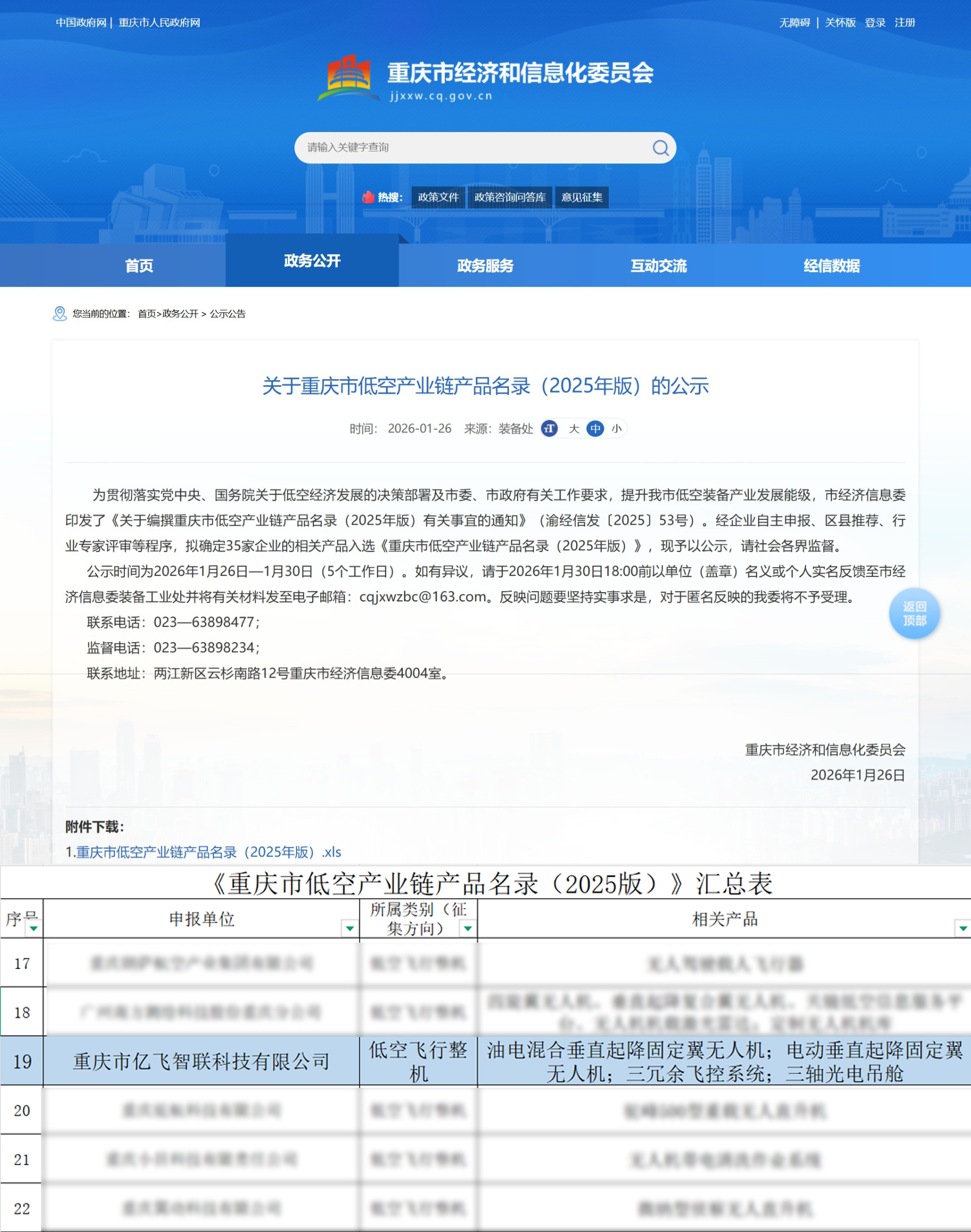
Public notice screenshot of the Low-Altitude Industry Chain Product Catalogue
“Two scenarios listed, one crowned benchmark
According to the official website of the Chongqing Municipal Commission of Economy and Information Technology, the 2025 Low-Altitude Equipment + Typical Application Scenario list was established as a municipal-level authoritative recognition to promote a group of typical low-altitude equipment application scenarios featuring high standards, innovative application models and notable application results.
The list selected 44 outstanding cases Among them, there are 10 benchmark scenario cases and 34 typical scenario cases, covering low-altitude aircraft, low-altitude aircraft components, security and countermeasure equipment, navigation support equipment, inspection and testing equipment and other fields. Both of Efly’s application scenarios made the list: the “Integrated UAV Coastal Patrol Application Scenario” was successfully selected among the ten benchmark application scenario cases, and the “UAV High-Precision Modelling and Geodetic Surveying Application Scenario” was included among the typical application scenario cases. Efly is one of the few enterprises to achieve two-scenario inclusion and a benchmark win in this selection, and with hardcore strength and rich field experience it has set a fine example for scenario-based application of low-altitude equipment in Chongqing.
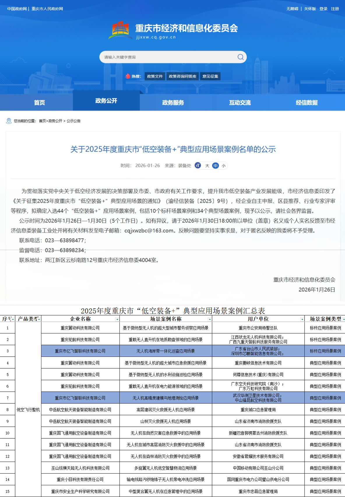
Public notice screenshot of the Low-Altitude Equipment + Scenarios list
Both of Efly's selected application scenarios start from real operational needs, using low-altitude equipment technology to build solutions that address genuine industry pain points:
(1) Benchmark application scenario: integrated UAV coastal-zone patrol
This scenario focuses on the core security requirements of port areas and coastlines, carrying out normalised all-domain control work and comprehensively patrolling and monitoring key locations such as terminal operating areas, anchorage channels and surrounding waters. Drawing on the flexible and agile operational advantages of drones, it can precisely identify abnormal activities such as unauthorised vessels entering hazardous control zones, quickly check for weak links in perimeter security and promptly warn of safety risks.
Compared with traditional ground-based maintenance and control modes, drones equipped with high-definition devices achieve panoramic coverage from a three-dimensional perspective, making up for the limited field of view and numerous blind spots of ground patrols. This builds a three-dimensional security system combining air and ground, greatly improving the precision, response efficiency and overall protection level of port and coastline security control, and reinforcing a technological barrier for the safe and stable operation of the region.
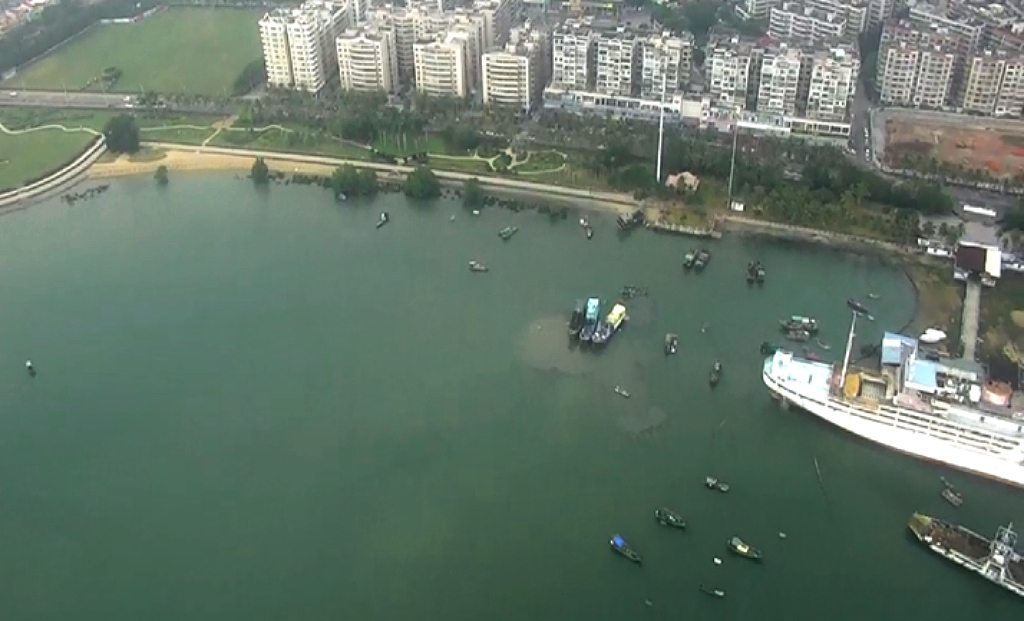
UAV patrol footage at port terminals
(2) Typical application scenario: high-precision UAV modelling and geographic surveying
This scenario draws on the advantages of drone low-altitude sensing and aerial survey technology to complete the surveying and mapping of three-dimensional maps with high efficiency and precision, breaking through the efficiency bottleneck and accuracy limitations of traditional surveying methods when operating in complex terrain and over large areas. With a lightweight, high-efficiency, high-resolution operating model, it offers a brand-new solution for geographic information collection and greatly improves the timeliness, precision and completeness of surveying data. By building high-fidelity three-dimensional geographic models, it provides reliable base map data and decision support for territorial spatial planning, engineering construction, resource management, emergency assurance and other fields.

UAV island and reef surveying footage
This time four equipment series The successful inclusion of its two application scenarios in the municipal list is both full recognition by the Chongqing Municipal Commission of Economy and Information Technology of Efly’s technical capabilities and application achievements, and an encouragement to the company’s continued research and innovation. From safeguarding coastal safety and reinforcing a three-dimensional security defence line, to precisely surveying the land and building a digital geographic foundation, Efly will press on with honour, constantly refining its technology, deepening its scenarios and optimising its solutions, empowering more industries with UAV technological innovation and moving steadily ahead on the broad track of the low-altitude economy to deliver further successes.